
Slieve Carr [Slieve Cor] [Corrshliabh]
Good walks are even better shared.
Overview
Slieve Carr [Slieve Cor] [Corrshliabh]
Nestled in the stunning Nephin Beg Range of County Mayo, Slieve Carr stands proud with an elevation of 722 meters. This Marilyn not only boasts impressive views but also an intriguing geological history.
Geology
The terrain of Slieve Carr is formed from volcanic action, dominated by andesitic lava flows. The rocky outcrops and slopes tell tales of a tumultuous past, making it a hot spot (pun intended) for geology enthusiasts.
Hiking Routes
There are a couple of popular routes to summit Slieve Carr:
- Curraghmore to Slieve Carr: A moderate 10.5 km trek, this route meanders through heather-laden slopes and rocky areas. Expect this to take roughly four hours, depending on your pace and how often you stop for photos.
- Knockskagh Loop: For the more adventurous, this challenging 12 km loop offers stunning vistas along the way. It will take about five hours, and you'll leave no stone unturned—literally.
Summit Features
At the top, hikers are welcomed by a robust cairn that acts as a compass for wandering souls. The surrounding rocks serve as perfect perches for those who want to marvel at the beauty of nature and snap a few selfies.
Terrain
Be prepared for a mix of grassy slopes interspersed with rocky patches, and perhaps a few boggy areas capable of turning your boots into sponges. A waterproof pair is highly recommended!
Views
Upon summiting Slieve Carr, the views take centre stage.
Highlights
Gaze upon the magnificent Nephin Beg Range and stretch your eyes towards the Atlantic Ocean in the distance. On a crystal-clear day, the scenery is nothing short of breathtaking, showcasing the Erris Peninsula and Achill Island.
Best Seasons
The views are at their best during late spring and summer, when the flora is blooming and the skies tend to be kinder.
Hazards
While hiking this beauty, don't underestimate the power of Mother Nature. Weather can change faster than you can say 'raincoat', especially in winter. Loose rocks and bogs are also waiting to grab your attention—so tread carefully.
Nearby Summits
If you're feeling ambitious, nearby Nephin (806 m) and Carn Dun (672 m) offer further adventures and additional scenic views of the local landscape.
Access
Nearest Parking
Curraghmore serves as the main starting point, with limited parking. Arriving early is key if you're planning this adventure on a weekend!
Public Transport
While convenient, public transport can be a bit sparse, so a car is highly recommended to reach the starting trailhead easily.
Nearest Town
Ballina is your closest option for re-fuelling after your hike.
Facilities
Head back to Ballina post hike to find a variety of cafes and restaurants to replenish your energy with some delicious local cuisine, should you need a little human interaction after your wilderness escape.
History
Name Meaning
The mountain's name in Gaelic reflects its landscape—'Slieve' refers to a mountain, while 'Carr' or 'Cor' suggests a heap of stones, so it’s spot on!
Significance
Slieve Carr isn’t just a pretty face; it has embraced local folklore and stories that add richness to the cultural tapestry of the region.
In summary, Slieve Carr is not just a walk in the park; it’s an adventure filled with history, stunning views, and a bit of geological research to spice things up. Happy hiking!
Explore routes near Slieve Carr [Slieve Cor] [Corrshliabh]
Public walks starting within 80 km of this hill. Nearby does not mean a route reaches the summit; check its map and access before setting out.
No public routes are currently listed within 80 km of Slieve Carr [Slieve Cor] [Corrshliabh] on Walkmates. This does not mean there are no paths here. Explore the map and check local access information before planning a walk.
Route planning notes
These notes describe possible approaches, not verified navigable routes or permission to cross land. Check current paths, local access rules and conditions before setting out.
Curraghmore to Slieve Carr
A popular route starting at Curraghmore, winding through heathy slopes and rocky patches before reaching the summit.
Knockskagh Loop
This loop includes several viewpoints and is great for those wanting to experience the surrounding vistas while summiting Slieve Carr.
Make a day of it, together
Find someone to share the walk with, or organise a day out along a route you like.
Hill facts and local notes
Classifications
Elevation
721m
2,365 ft
Prominence
648m
Coordinates
54.0682, -9.6582
F914144
OS Map
23
At the Summit
The summit features a prominent cairn which serves as a notable landmark, alongside a few rock outcrops offering great photo opportunities against the backdrop of the surrounding valleys.
Terrain & Geology
Slieve Carr is predominantly composed of rocks from the volcanic activity that shaped the region, specifically andesitic lavas. The mountain's rugged terrain reflects its geological past, making it an intriguing subject for geologists and hobbyists alike.
Views & Scenery
From the summit, you can enjoy panoramic views of the Nephin Beg Range, as well as the Atlantic Ocean on a clear day. The sight of the Erris Peninsula and Achill Island will surely take your breath away.
History & Heritage
Name Origin
The name 'Slieve Carr' is derived from Gaelic, where 'Slieve' means mountain and 'Carr' or 'Cor' refers to a round hill or a heap of stones, which is quite fitting given the summit's features.
Historical Significance
Historically, Slieve Carr has been a site for local folklore and stories, enriching the cultural narrative of the area.
Getting There & Facilities
Check current local access restrictions, parking rules and transport timetables before travelling. These notes do not confirm public access to the summit.
Parking
Parking is available at Curraghmore, where the trailhead begins. Spaces are limited, so plan to arrive early, especially on weekends.
Public Transport
The nearest town, Ballina, offers bus services, but it's recommended to have a car to reach the start of the trails conveniently.
Nearby Facilities
Ballina has several cafes, restaurants, and public toilets. It's wise to stock up on snacks and water before hitting the trail.
Safety Information
Known Hazards
- Beware of sudden weather changes, as conditions can shift rapidly, especially in winter months. Keep an eye out for loose rocks and wet, boggy areas.
General Safety Tips
- Check weather conditions before setting out
- Carry appropriate clothing and equipment
- Let someone know your planned route
- Take a map, compass, and GPS device
- Carry emergency supplies: food, water, first aid kit, torch
Hills
Some common questions about the hills answered
Are there group walks up Slieve Carr [Slieve Cor] [Corrshliabh]?
Many walkers use Walkmates to join or organise walks with others. You can check for group walks around Slieve Carr [Slieve Cor] [Corrshliabh] through the maps
Are there other walkers around Slieve Carr [Slieve Cor] [Corrshliabh]?
Activity varies by location and time, but Walkmates lets you see whether others have shared walks or shown interest in this area. Find other people through the walking friends search walking friends for Slieve Carr [Slieve Cor] [Corrshliabh] search or of course create your own walk for Slieve Carr [Slieve Cor] [Corrshliabh]
Can I organise a walk to Slieve Carr [Slieve Cor] [Corrshliabh]?
Yes. If there aren’t any walks listed already, you can create a walk and make it available for others to join.
If you're signed up to Walkmates, you can create a walk to Slieve Carr [Slieve Cor] [Corrshliabh].
How do I find a walk up this hill?
There are often multiple ways to walk this hill, depending on experience and route preference. Walkmates helps you explore walks and routes that others have shared.
Can I suggest a new route up Slieve Carr [Slieve Cor] [Corrshliabh]?
Yes. You can suggest or create routes to share with others. Walkmates focuses on the social side of walking, so routes are used to help people organise walks and explore areas together, rather than as detailed navigation tools or route libraries.
Other uses really appreciate knowledgeable walkers sharing their routes. Share your favourite route to Slieve Carr [Slieve Cor] [Corrshliabh] here
The is an error or something incorrect about this hill. How do I let you know?
We always strive to keep the information on Walkmates as accurate as possible. If you find an error, please let us know through the contact form and we'll aim to correct it as quickly as possible
Community Discussion
Comments
Location
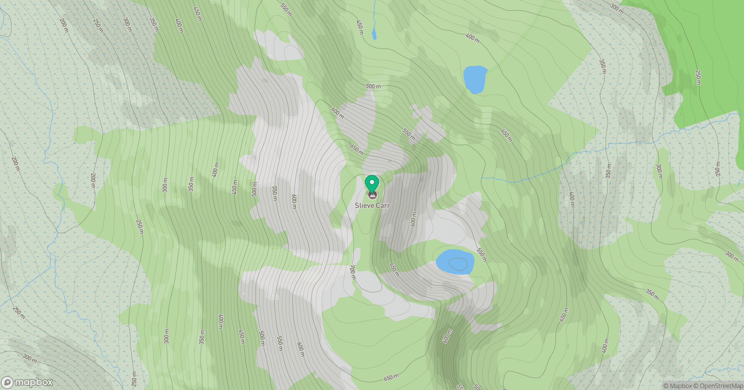
Grid reference: F914144
View on OpenStreetMapOpens a map in a new tab, centred on the hill.
Hills within 30 km
Straight-line distance, not a walking route or confirmation of access.
No comments yet. Be the first.